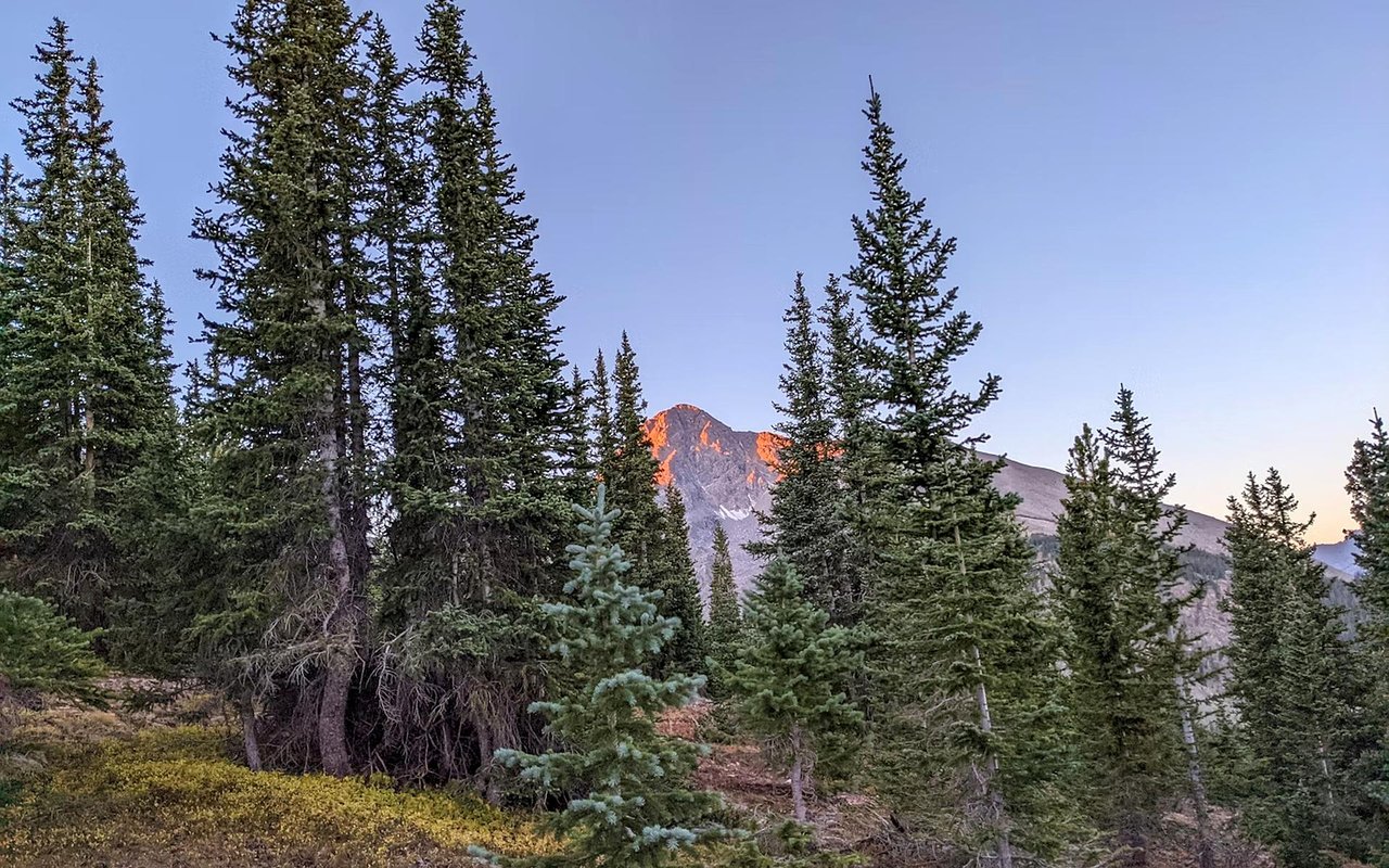
The Rocky Mountain town of Buena Vista, Colo., yields exceptional hiking opportunities. The town's unique location provides access to towering Collegiate Peaks, the scenic Arkansas River, and vast stretches of national forest land. The natural landscape around Buena Vista CO hiking spots features everything from challenging climbs to tranquil riverside strolls.
These trails immerse hikers in alpine meadows, dense evergreen forests, and dramatic geological formations.
Barbara Whipple Trail
The Barbara Whipple Trail system is a popular and accessible network of interconnecting trails across the Arkansas River from Buena Vista's South Main district. This system offers convenience for a quick outing and provides remarkable views of the Collegiate Peaks to the west. The trails honor Barbara Whipple, a local artist who loved hiking in the area.
One prominent route within this system is the old Midland Railroad grade, a historical path that once transported passengers and freight. Hikers can traverse through pinion pines and rocky terrain, enjoying sweeping vistas of the Arkansas River and the surrounding mountains. The system also includes the original "Hack Road," a steep and winding route used by stagecoaches in the late 1800s, providing a glimpse into the area's rich history.
One prominent route within this system is the old Midland Railroad grade, a historical path that once transported passengers and freight. Hikers can traverse through pinion pines and rocky terrain, enjoying sweeping vistas of the Arkansas River and the surrounding mountains. The system also includes the original "Hack Road," a steep and winding route used by stagecoaches in the late 1800s, providing a glimpse into the area's rich history.
Browns Creek Waterfall Trail
The Browns Creek Waterfall Trail offers a moderately challenging hike to a beautiful cascading waterfall. Located in Nathrop, a short drive from Buena Vista, this trail takes adventurers through fragrant pine and aspen forests, interspersed with vibrant wildflower meadows during the appropriate seasons. It is a favored spot for a half-day excursion.
The trail spans approximately six miles round-trip and features an elevation gain of around 1,100 feet. The initial section of the hike is often exposed, requiring early morning starts during warmer months. The constant presence of the trickling creek provides a soothing auditory element throughout much of the journey, culminating in the impressive waterfall.
The trail spans approximately six miles round-trip and features an elevation gain of around 1,100 feet. The initial section of the hike is often exposed, requiring early morning starts during warmer months. The constant presence of the trickling creek provides a soothing auditory element throughout much of the journey, culminating in the impressive waterfall.
Alpine Tunnel Trail
The Alpine Tunnel Trail in the San Isabel National Forest provides a unique hiking experience following the historic grade of the old Denver, South Park, and Pacific Railroad. While the original tunnel has been demolished, the trail offers remarkable panoramic mountain views, making it a prime example of Buena Vista CO hiking spots.
This trail can be explored as a 5.5-mile out-and-back hike or extended to a 9.5-mile loop to Williams Pass. It transitions from a wider path along the old railroad grade to a single track as it climbs over ridges, revealing breathtaking vistas of the valley. The hike leads to the historic Alpine Station, where remnants of old railroad tracks and buildings recall Colorado's railway past.
This trail can be explored as a 5.5-mile out-and-back hike or extended to a 9.5-mile loop to Williams Pass. It transitions from a wider path along the old railroad grade to a single track as it climbs over ridges, revealing breathtaking vistas of the valley. The hike leads to the historic Alpine Station, where remnants of old railroad tracks and buildings recall Colorado's railway past.
Ptarmigan Lake Trail
The Ptarmigan Lake Trail is a highly scenic and moderately challenging hike located just outside Buena Vista, accessible via Cottonwood Pass. This trail leads to a stunning alpine lake nestled in a high mountain cirque framed by imposing peaks. The hike measures approximately 6 to 6.8 miles round-trip and has an elevation gain of around 1,476 feet.
The trail begins by climbing through dense pine forests before opening into expansive, flower-dotted meadows. Once at Ptarmigan Lake, hikers are rewarded with incredible views of Jones Mountain, Gladstone Ridge, Turner Peak, and Mount Yale. This hike is considered one of the best for exploring blooming meadows during summer and offers a truly immersive alpine experience.
The trail begins by climbing through dense pine forests before opening into expansive, flower-dotted meadows. Once at Ptarmigan Lake, hikers are rewarded with incredible views of Jones Mountain, Gladstone Ridge, Turner Peak, and Mount Yale. This hike is considered one of the best for exploring blooming meadows during summer and offers a truly immersive alpine experience.
Mount Yale Trail
For those seeking a significant challenge, the trail ascending Mount Yale offers an intense and rewarding climb to the summit of one of Colorado's prominent 14,000-foot peaks. Located a short drive from Buena Vista, this trail spans over nine miles and involves considerable elevation gains and rugged, rocky conditions.
Reaching the 14,196-foot summit of Mount Yale is not for the faint of heart, but the profound panoramic views from the top are a significant reward. Hikers are treated to expansive vistas of the surrounding mountain ranges and prominent peaks. The trail features exposed ridges and demanding terrain, making it a true test of endurance and a memorable achievement for experienced hikers.
Reaching the 14,196-foot summit of Mount Yale is not for the faint of heart, but the profound panoramic views from the top are a significant reward. Hikers are treated to expansive vistas of the surrounding mountain ranges and prominent peaks. The trail features exposed ridges and demanding terrain, making it a true test of endurance and a memorable achievement for experienced hikers.
Lost Lake Trail
The Lost Lake Trail offers a relatively easy and rewarding hike to a beautiful alpine lake, making it among the most scenic Buena Vista CO hiking spots. This trail has seen recent re-routing and now features a new parking area at its trailhead, making access more straightforward. It's an excellent option for those seeking high-elevation views without extensive mileage or steep sections.
The trail, approximately 2.6 to 3.5 miles round-trip, gains around 420 to 465 feet in elevation. It traverses through intermittent meadows and spruce forests, eventually revealing rocky peaks and the picturesque alpine lake with a small island. The trail can be muddy in spots, requiring minor detours. Its relative ease and stunning destination make it popular for a refreshing outing.
The trail, approximately 2.6 to 3.5 miles round-trip, gains around 420 to 465 feet in elevation. It traverses through intermittent meadows and spruce forests, eventually revealing rocky peaks and the picturesque alpine lake with a small island. The trail can be muddy in spots, requiring minor detours. Its relative ease and stunning destination make it popular for a refreshing outing.
Agnes Vaille Falls Trail
The Agnes Vaille Falls Trail offers a short, sweet hiking experience near Buena Vista. It leads to a tall, impressive waterfall. Located in Nathrop, close to Mount Princeton Hot Springs, this trail is particularly appealing for its quick reward and scenic beauty.
The trail is approximately 1.1 to 1.2 miles out-and-back with an elevation gain of about 505 feet. It provides a straightforward path to the waterfall, which can be particularly striking when it freezes over in winter. Its brevity and natural beauty make it an accessible option for those seeking a quick dose of nature or a pleasant stroll to a scenic landmark.
The trail is approximately 1.1 to 1.2 miles out-and-back with an elevation gain of about 505 feet. It provides a straightforward path to the waterfall, which can be particularly striking when it freezes over in winter. Its brevity and natural beauty make it an accessible option for those seeking a quick dose of nature or a pleasant stroll to a scenic landmark.
North Cottonwood Creek Trail
The North Cottonwood Creek Trail in the Collegiate Peaks Wilderness west of Buena Vista provides a beautiful and serene hiking experience. This trail, approximately three miles in length, is easy to hike under ideal weather conditions, making it suitable for a relaxed outing.
The trail is at its best and most easily accessible during the warmer months, generally from June through November. It follows Cottonwood Creek, meandering through peaceful forests and open areas. While the hike is not difficult, the road to the trailhead can be challenging for vehicles without four-wheel drive. Moose and deer sightings are common in this scenic and quiet area.
The trail is at its best and most easily accessible during the warmer months, generally from June through November. It follows Cottonwood Creek, meandering through peaceful forests and open areas. While the hike is not difficult, the road to the trailhead can be challenging for vehicles without four-wheel drive. Moose and deer sightings are common in this scenic and quiet area.
Work with First Century 21 Community First
If you're planning to buy or sell property in Salida, Century 21 Community First offers the local insight and real estate experience to guide you through every step of the process. With deep roots in the community and decades of market knowledge, their team understands the nuances of land, residential, and commercial real estate in the Upper Arkansas Valley.
Connect with them to start your real estate journey with a team that puts local expertise to work for you.
Connect with them to start your real estate journey with a team that puts local expertise to work for you.